

In the era of modern enterprise GIS, seamless connectivity between office analysts and field workers is no longer a luxury—it is an absolute necessity. For years, organizations relied on a fragmented ecosystem of mobile applications to collect spatial data, navigate terrain, track location history, and inspect critical infrastructure. Recognizing the inefficiency of managing multiple disjointed mobile tools, Esri introduced a unified, powerful solution: ArcGIS Field Maps. As Esri’s flagship mobile application, ArcGIS Field Maps combines mapping, data collection, location tracking, and field workflow management into a single, intuitive platform.
Whether you are managing municipal utility assets, conducting environmental impact assessments, responding to natural disasters, or maintaining telecommunications infrastructure, ArcGIS Field Maps revolutionizes field operations GIS by driving operational efficiency and improving data integrity. In this comprehensive guide, we will explore everything you need to know about Esri Field Maps, from its core capabilities and workflow configurations to offline mapping strategies, high-accuracy data collection, and practical deployment best practices.
Table of Contents
What is ArcGIS Field Maps?
ArcGIS Field Maps is Esri’s primary mobile data collection and field operations app for iOS and Android devices. Built directly on the ArcGIS system, it integrates natively with ArcGIS Online, ArcGIS Enterprise, and ArcGIS Portal. The primary motivation behind developing ArcGIS Field Maps was app convergence. Prior to its launch, field crews had to switch between several standalone Esri mobile applications:
- ArcGIS Collector: Used for high-accuracy spatial data collection and asset Editing.
- ArcGIS Explorer: Used for viewing interactive maps, searching layer attributes, and adding markup annotations.
- ArcGIS Tracker: Used for passive, battery-efficient real-time location tracking.
- ArcGIS Navigator: Used for turn-by-turn navigation across custom road networks.
- ArcGIS Workforce: Used for task assignment and dispatching.
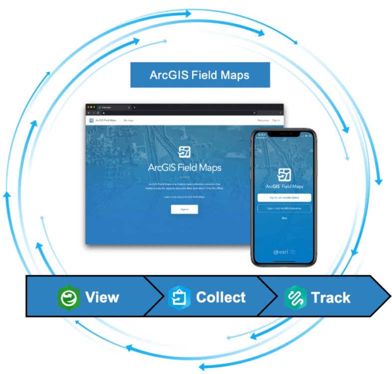
ArcGIS Field Maps combines the functionalities of Collector, Explorer, and Tracker into a streamlined, single-app experience. By consolidating these functions, Esri simplified the field user interface, reduced mobile device memory overhead, eliminated duplicate map downloads, and substantially lowered administration costs for enterprise GIS managers. Field workers no longer need to jump between separate software tools to perform their day-to-day work; everything they need to view maps, capture geographic information, record observations, and broadcast location tracking is centralized within a unified GIS field app.
Key Features and Capabilities of ArcGIS Field Maps
To fully appreciate how ArcGIS Field Maps optimizes geospatial workflow execution, it is essential to examine the core functionality integrated into the application.
1. High-Accuracy Mobile Data Collection
Data quality is the cornerstone of any geographic information system. ArcGIS Field Maps enables field crews to capture point, line, and polygon features with extreme spatial accuracy. The application interfaces seamlessly with external GNSS (Global Navigation Satellite System) receivers via Bluetooth, such as Leica, Trimble, Bad Elf, and Eos Arrow devices. Field personnel can monitor real-time satellite positioning metrics—including horizontal accuracy, vertical accuracy, RMS errors, PDOP, HDOP, and fix type (such as RTK Fixed or DGPS)—directly on screen.
Furthermore, the app supports orthometric height calculations using custom GEOID models, metadata logging (recording receiver name, fix time, point count, and positional error alongside feature geometries), and high-accuracy snapping to existing spatial features.
2. Advanced Map Viewing and Visualization
Field crews can access rich, vector-based maps generated in ArcGIS Online or ArcGIS Enterprise. The app supports dynamic vector basemaps, raster imagery, complex cartographic symbology, map markup layer creation, distance and area measurements, and attribute pop-ups configured with Arcade expressions. Arcade scripting allows administrators to display calculated fields, conditional formatting, and dynamically formatted attribute summaries in real time without altering underlying database schema.
3. Smart Forms and Attribute Validation
One of the most transformative elements of ArcGIS Field Maps is its web-based Smart Form builder. GIS administrators can configure intelligent, user-friendly forms that guide field workers through data entry, reducing human error and enforcing data standardization in the field. Key smart form capabilities include:
- Conditional Visibility: Show or hide specific form fields based on previously selected attributes (e.g., revealing structural inspection fields only when an asset state is marked as “Damaged”).
- Required and Read-Only Fields: Enforce data completeness by marking critical fields as mandatory prior to submission.
- Coded Value Domains and Picklists: Restrict data input to preset drop-down menus, eliminating typographical errors.
- Form Groups and Formatting: Organize complex inspection forms into collapsible groups and logical sections.
- Default Value Logic and Arcade Calculations: Automatically calculate values (e.g., calculating inspection pass/fail status or auto-populating timestamps and user IDs).
4. Real-Time Location Tracking
Understanding where field personnel are located enhances operational awareness and worker safety. Through location tracking powered by the ArcGIS Location Referencing and Tracking services, Field Maps records real-time breadcrumbs of field staff. Location tracks are stored locally on the mobile device and securely uploaded to the organization’s enterprise tracking layer whenever network connectivity is available. Administrators can analyze historical tracks to optimize routing, verify site visits, and ensure personnel safety during hazardous field operations.
5. Geofencing and Dynamic Field Alerts
ArcGIS Field Maps supports location-aware geofencing. Administrators can establish virtual boundaries around points or polygons within web maps. When a mobile worker enters or exits a designated geofence zone, the application can trigger automated alerts, toggle location tracking on or off, or warn workers regarding active hazard zones, restricted property lines, or critical safety compliance protocols.
ArcGIS Field Maps vs Collector: Why Migration is Essential
Many GIS professionals who operated legacy Esri field applications frequently evaluate the transition in terms of arcgis field maps vs collector. While Collector served as the benchmark for mobile spatial data collection for years, Esri officially retired ArcGIS Collector alongside Explorer and Tracker.
Transitioning from Collector to ArcGIS Field Maps offers several immediate technical advantages:
| Feature Capability | Legacy ArcGIS Collector | Modern ArcGIS Field Maps |
|---|---|---|
| App Footprint | Standalone data collection only | Unified map viewing, collection, markup, and tracking |
| Form Building | Basic field configuration in web map | Advanced Smart Forms with conditional logic and Arcade |
| Offline Capabilities | Manual map downloads & basic sync | Pre-planned map areas, auto-sync, offline basemaps |
| User Interface | Traditional GIS interface | Modern, user-centric interface optimized for field conditions |
| Geofencing Support | Not supported | Full native geofence support for alerts and tracking toggles |
| Markup Sharing | Limited local annotations | Enterprise markup sharing across ArcGIS ecosystem |
For enterprise GIS administrators, migrating from legacy tools to esri field maps requires minimal effort. Web maps configured for Collector function natively inside Field Maps. However, taking full advantage of modern features—such as setting up smart forms in arcgis field maps—requires using the Web App component integrated into ArcGIS Online and Enterprise.
How to Set Up and Configure ArcGIS Field Maps
Deploying a successful field operations GIS initiative requires thoughtful preparation in the office before field personnel step into the environment. The workflow involves map preparation, smart form design, offline area definition, and mobile deployment.
Step 1: Prepare the Spatial Data Layer
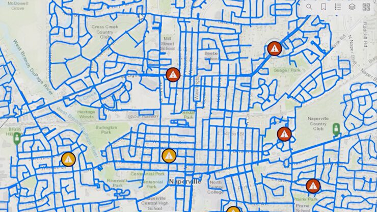
To enable feature editing and mobile data collection, spatial data layers must be hosted as web feature layers in ArcGIS Online or ArcGIS Enterprise. Ensure that the hosted feature layers have editing capabilities enabled (Create, Delete, Update, and Query) and that global IDs are present to maintain data integrity and support offline database synchronization.
Step 2: Create a Dedicated Web Map
Build a focused web map using the Map Viewer in ArcGIS Online or ArcGIS Enterprise. Add required operational feature layers, set appropriate scale dependency ranges, configure pop-ups using Arcade syntax, and select an appropriate basemap. For remote projects, choose a vector tile basemap, as vector tiles require significantly less storage space on mobile devices compared to traditional raster basemaps.
Step 3: Configure Forms Using the Field Maps Designer
Access the ArcGIS Field Maps Web App (Field Maps Designer) through your ArcGIS organizational account. The web app provides a canvas to design field experiences:
- Select your target web map within the Field Maps Designer.
- Navigate to the Forms tab and select the layer you wish to edit.
- Drag and drop attribute fields from the schema panel onto the form builder layout.
- Organize attributes into logical Form Groups (e.g., General Information, Condition Assessment, Environmental Parameters).
- Set field display names, placeholder text, and helpful description hints.
- Configure Visibility Rules using the Arcade expression builder to establish conditional form logic.
- Save form settings to write the configuration directly into the web map definition.
Step 4: Configure App Settings and Markup Options
Within the Field Maps Designer, administrators can adjust operational settings to streamline user experiences. Options include enabling photo attachment sizes (Medium, Large, Actual Size), turning on location tracking options, setting required positional accuracy thresholds (e.g., requiring accuracy under 5 centimeters before allowing point capture), and enabling location streaming options for capturing linear assets like pipelines and footpaths.
How to Use ArcGIS Field Maps Offline
Field workers frequently operate in remote areas, subterranean environments, or rural zones with poor or nonexistent cellular connectivity. A crucial operational requirement for any mobile GIS app is robust offline capability. Understanding how to use arcgis field maps offline guarantees uninterrupted data collection and map access regardless of cellular network status.
Option 1: Creating Pre-Planned Map Areas (Recommended for Enterprise Admin)
Pre-planned map areas are packaged in advance by GIS administrators and stored on ArcGIS Online or Enterprise servers. Field workers simply download the pre-packaged map tile packages before heading out into remote project sites.
- In the Field Maps Designer web application, select your web map and navigate to the Offline section.
- Enable the Offline Mode toggle switch.
- Click Map Areas and select Create Area.
- Draw a geographic boundary box around the operational study site.
- Set the level of detail (zoom depth) required for the basemap and feature layers.
- Set an update schedule (e.g., refresh feature data daily or weekly).
- Save and build the map area. When mobile workers open the field app on their mobile devices, the pre-planned offline area appears with a single-click download button.
Option 2: On-Demand Offline Map Area Creation (User-Defined)
If field crews need to work in unplanned geographic areas, they can generate custom offline map areas directly from their mobile devices while connected to Wi-Fi or cellular networks:
- Open the ArcGIS Field Maps application on your iOS or Android mobile device.
- Search for the required web map.
- Tap the More Options (…) icon on the map card and select Add Offline Area.
- Pan and zoom the bounding box over the designated work area on screen.
- Adjust the level of map detail slider to balance visual clarity against total file download size.
- Tap Download Area. The app fetches basemap tiles, spatial layers, and smart form schemas, storing them directly on local device storage.
Offline Data Collection & Data Synchronization Workflow
Once working offline, mobile users can add new point, line, or polygon features, capture geo-tagged attachments, fill out smart forms, and perform spatial markups completely detached from the internet. All edit operations are committed to a local SQLite/Geodatabase environment on the mobile device.
When workers return to an environment with Wi-Fi or cellular service:
- Open the ArcGIS Field Maps application.
- Tap the map card containing offline edits.
- Click the Sync button (or enable Auto-Sync under app settings).
- The application securely uploads local field edits, photo attachments, and attribute changes to the enterprise feature layer in ArcGIS Online or ArcGIS Enterprise, while downloading any updates made in the office by other team members.
Real-World Use Cases Across Key Industries
ArcGIS Field Maps provides flexible spatial workflows adaptable to almost any industry reliant on geographical assets. Here is how leading sectors leverage the platform:
1. Electric, Gas, and Water Utilities
Utility organizations manage vast networks of linear and point infrastructure dispersed across vast territories. Field Maps enables utility crews to perform valve exercise inspections, pole asset assessments, gas leak detection logging, and underground utility mapping. Crews connect GNSS receivers to capture centimeter-accurate location data for buried assets, reducing damage during future excavation work.
2. Environmental Science and Forestry
Environmental scientists, ecologists, and forestry professionals use ArcGIS Field Maps to conduct wetland delineations, invasive species mapping, forest inventory audits, and wildlife habitat monitoring. Utilizing smart forms, researchers record vegetative species, canopy coverage percentages, soil moisture levels, and environmental indicators without carrying cumbersome physical paper datasheets.
3. Municipal Government and Public Works
Local governments utilize Field Maps to audit urban infrastructure, including sidewalk damage inspections, sign inventory audits, pothole repair tracking, tree canopy management, and storm drain maintenance. Smart forms ensure that municipal field inspectors collect standardized data that feeds directly into public work order management systems.
4. Emergency Response and Disaster Recovery
During natural disasters like hurricanes, wildfires, or flooding, rapid situational awareness is vital. Search and rescue crews, damage assessment teams, and emergency management personnel use Field Maps to record structural damage, log hazard points, mark emergency evacuation routes, and transmit real-time location tracks back to emergency management operations centers.
Best Practices for Implementing ArcGIS Field Maps
To maximize investment value and ensure smooth operational adoption across field and office teams, follow these industry best practices during deployment:
1. Optimize Mobile Web Maps for Performance
Keep web maps lightweight to ensure fast performance on field mobile hardware. Remove unnecessary layers, suppress redundant labels, set appropriate scale-dependent visibility thresholds, and use vector basemaps rather than heavy raster basemaps to reduce offline file sizes and speed up map rendering times.
2. Standardize Form Design with Smart Logic
Avoid cluttering forms with dozens of visible attributes. Group related fields, restrict choices using domains, auto-populate date and user fields, and leverage conditional visibility to keep form interfaces clean. A well-designed smart form reduces the time field workers spend typing on small screens and minimizes data entry mistakes.
3. Establish GNSS Accuracy Profiles and Data Requirements
Configure accuracy profiles within the app settings if your data collection requires high precision. Set positional accuracy thresholds (for instance, prohibiting point capture if GPS accuracy exceeds 10 centimeters) to prevent mobile workers from capturing imprecise spatial data when standing under dense tree canopies or urban canyons.
4. Implement Robust Governance and Security Controls
Control access rights to operational maps using ArcGIS role-based access control (RBAC). Assign field crews appropriate user types (such as Field Worker or Mobile Worker user types) and editing privileges. Ensure feature layers use field-level security and prevent unauthorized deletion of operational feature data.
5. Conduct Thorough Field Testing Before Deployment
Before launching a field campaign across large mobile teams, test web maps, smart form expressions, offline map downloads, and data sync workflows in controlled environments. Test how forms perform offline, verify that high-accuracy GPS units pair correctly via Bluetooth, and confirm that attribute data synchronizes seamlessly back to the enterprise GIS geodatabase.
Elevate Your Geospatial Field Workflows
ArcGIS Field Maps represents a major leap forward in field operations GIS software. By consolidating spatial data collection, digital map viewing, high-accuracy GPS integration, location tracking, and smart form capabilities into a unified mobile platform, Esri has empowered organizations to modernize field operations and bridge the operational gap between field crews and office analysts.
Whether your objective is migrating away from legacy tools like ArcGIS Collector, automating remote asset inspections, or standardizing spatial data collection across multi-disciplinary teams, implementing ArcGIS Field Maps delivers unmatched efficiency, accuracy, and operational awareness. By planning web maps carefully, leveraging smart forms, configuring offline areas, and adhering to spatial data governance best practices, your organization can fully unlock the enterprise value of location intelligence across every field operation.